All categories
Featured selections
Trade Assurance
Buyer Central
Help Center
Get the app
Become a supplier
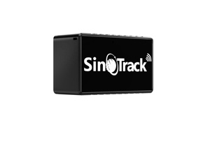
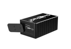
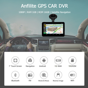
(2142 products available)


 Ready to Ship


 Ready to Ship


 Ready to Ship


 Ready to Ship


 Ready to Ship


 Ready to Ship
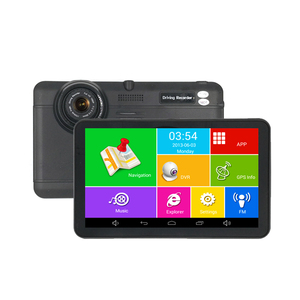


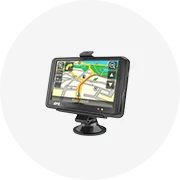
There are several types of UK GPS maps for Android trucks, including:
TomTom GPS
TomTom GPS offers reliable navigation with real-time traffic updates, offline maps, voice guidance, and route customization. The GPS also has a mobile app, allowing users to access navigation and features on their mobile devices.
Sygic GPS
Sygic GPS navigation provides offline maps, voice guidance, and advanced safety features like a head-up display. It also has additional features like real-time traffic information, road hazard warnings, and advanced safety features like a speed camera warning.
CoPilot GPS
Copilot GPS offers customizable routing for commercial purposes, including truck restrictions, address management, and offline maps. Users can access navigation features on their mobile devices with the CoPilot GPS, which offers flexible plans and subscriptions.
Navmii GPS
Navmii GPS provides offline navigation, voice guidance, and free access to essential navigation features. Users can access additional features like real-time traffic information and advanced routing with a Navmii GPS premium subscription, providing flexible pricing options.
HERE WeGo
HERE WeGo is a map service that offers offline maps, public transport info, and route planning. It provides essential navigation features with a focus on flexibility and adaptability, which is useful for various transportation modes and needs.
Different specifications affect how GPS for trucks in the UK operates and its accuracy. Here are some of the key specifications to consider:
Coverage:
UK GPS maps for Android trucks should cover all major roads and routes throughout the country. This includes motorways, A-roads, B-roads, and smaller regional roads.
Map Updates:
Regular map updates are essential for UK GPS maps to ensure users access the latest information. The updates incorporate changes such as new road constructions, closures, and traffic rules to maintain the accuracy and reliability of the GPS system.
Points of Interest (POI) Database:
A comprehensive POI database enhances the functionality of the UK GPS map for Android trucks. This database should include various locations such as service stations, rest areas, hotels, restaurants, and truck stops. The database allows drivers to access useful information and navigate efficiently.
Route Optimization:
Advanced algorithms for route optimization are a key aspect of GPS navigation for trucks. These algorithms consider real-time traffic data, historical traffic patterns, and the truck's specifications, such as height, weight, and length. The system uses the algorithms to determine the most efficient routes, thereby minimizing delays and optimizing the journey.
Voice Guidance:
In navigation, voice guidance is an essential feature. It provides turn-by-turn instructions to drivers in a clear and concise voice. The feature helps drivers to stay focused on the road by eliminating the need to look at the screen constantly.
Customizable Truck Profiles:
Customizable truck profiles are important for ensuring accurate route planning and navigation. Users can input specific details about their trucks, such as height, weight, length, and cargo type. The information allows the GPS system to take into account the truck's characteristics and avoid routes with restrictions or potential hazards.
Real-Time Traffic Information:
Real-time traffic data is a critical aspect of GPS for UK truck navigation. The feature integrates live traffic data, including incidents, congestion, and road closures, into the navigation system. The integration allows drivers to receive real-time traffic alerts and make informed decisions, such as rerouting to avoid delays and optimizing travel time.
Integration with Fleet Management:
GPS navigation systems for trucks in the UK can be integrated into fleet management platforms. This integration allows for real-time vehicle tracking, monitoring of driver performance, and communication between drivers and dispatchers. The feature enhances logistics efficiency and provides better coordination and visibility for fleet operations.
Connectivity:
Connectivity features like 4G, Wi-Fi, and Bluetooth enable communication between the GPS device and other truck systems or mobile devices. This allows for software updates, access to online services, and communication with dispatchers or contacts.
Maintaining a UK truck GPS system is crucial for ensuring accurate navigation and reliable performance. Here are some general maintenance tips:
There are a couple of things to consider when choosing the right Android GPS for a trucking business. They include:
Consider Route Optimization
Route optimization is crucial for logistics and transportation businesses to reduce costs and enhance service delivery. A GPS that offers route optimization for logistics provides the most efficient routes, considering truck restrictions like height and weight. It also gives real-time traffic updates and alternative routes to avoid congestion.
Road Restrictions and Hazards
The UK has certain roads that have restrictions and potential hazards that could affect truck navigation. These restrictions include low bridges, weight-limit roads, and narrow streets. Additionally, some areas are known for specific hazards like steep inclines or high wind zones. An updated GPS gives alerts on such restrictions and hazards, helping drivers plan safe routes and avoid dangerous situations.
Customizability
Customizability is an important feature when choosing a GPS for trucks. A customizable GPS allows setting preferences that match specific needs. This includes avoiding certain road types, preferred rest areas, and vehicle restrictions. Furthermore, a customizable GPS can integrate with other tools like fleet management systems, making it more useful for business operations.
Voice Guidance
Voice guidance is an important feature to consider when choosing a GPS for trucks. A clear voice guidance helps drivers navigate without looking at the screen. This ensures safety by allowing the driver to focus on the road. Additionally, GPS with voice guidance gives turn-by-turn directions and announces street names, reducing the chances of making wrong turns.
Community Feedback
Community feedback is an important aspect to consider when choosing a GPS for trucks. Online reviews, forums, and social media provide valuable insights into the performance and reliability of various GPS devices and apps. Furthermore, feedback from other truck drivers in the community can highlight strengths and weaknesses, helping choose a GPS that meets the requirements.
Updating GPS for truck navigation is a straightforward process that can be done in a few steps. To ensure that the truck's GPS receives the most up-to-date information, follow these instructions:
Q1: Are free GPS apps on Android phones good for truck navigation?
A1: While free GPS apps on Android phones can provide navigation, they may not be specifically designed for trucks. It's essential to use apps explicitly tailored for truck navigation to ensure route safety and compliance.
Q2: How often should GPS maps be updated for truck navigation?
A2: Ideally, GPS maps should be updated regularly, at least every few months. This ensures access to the latest road changes, closures, and new point-of-interest locations, maintaining accurate and reliable navigation.
Q3: Can I use the same GPS for a car and a truck?
A3: Some GPS devices are designed for both cars and trucks. However, choosing a GPS for trucks with adjustable settings for truck dimensions and weight restrictions is better. This prevents routing errors and ensures safety.
Q4: What should I do if my GPS map doesn't recognize a new road or change?
A4: If the GPS map doesn't recognize a new road, it could result from outdated maps. Update the GPS maps immediately. Additionally, report the change to the GPS provider so they can verify and update their data.
Q5: Is internet connectivity required for GPS navigation on trucks?
A5: While many GPS devices for trucks work online, some require internet connectivity for real-time updates. Connectivity can provide live traffic data, weather updates, and access to the latest map information, improving navigation accuracy.