All categories
Featured selections
Trade Assurance
Buyer Central
Help Center
Get the app
Become a supplier
(2762 products available)


 Ready to Ship


South surveying instruments provide spatial data for surveying, mapping, and construction. They evolved during the 20th century by combining early surveying tools like theodolites and transits with advanced optics and electronic measurement. This evolution met the need for more precise and efficient surveying in construction, land development, and infrastructure projects.
Various types of South surveying instruments include:
South Total Station
A South total station is used for measuring angles and distances in mapping and construction. It digitally records data to make the work faster and more precise. South total stations help surveyors make detailed maps and check that buildings are built in the right place according to plans.
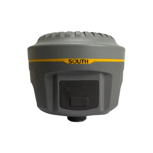
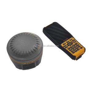
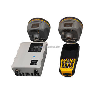
South GNSS
GNSS uses signals from satellites to measure locations on Earth. Surveyors attach GNSS receivers to their tripods to get precise position data anywhere, even in remote spots. South GNSS units save time and fuel by mapping land without needing to walk the boundaries like older tools.
South Telescopic لامي
It is an optical instrument enabling the precise measurement of distances between two points. The distance measured is the horizontal distance corrected for the earth's curvature and refraction.
South Laser تکن سٹیشن
South laser ranging uses a laser beam to accurately measure distances on land. It sends lasers to targets, faster and more precise than traditional tools. The system surveys land and checks if building construction is straight and level. Construction workers rely on its precision to align pillars, walls, and more accurately.
South surveying instruments have crucial importance in many industries due to their precision and effective working properties.
Construction
Surveying instruments are vital in construction projects for site analysis, project developments, and structure stability monitoring. These instruments enable accurate measurements for foundation laying, building framing, and other construction works to enhance safety and reduce costs.
Civil engineering
Surveying instruments help civil engineers create precise designs for roads, bridges, and other infrastructures. Engineers rely on accurate measurements to minimize errors, enhancing engineering and construction efficiency.
Oil and gas
In the oil and gas sector, surveying tools aid in mapping pipelines. Accurate spatial information minimizes environmental impacts and helps in meeting safety regulation compliance. Using these tools for planning and monitoring operations reduces risks and boosts project efficiency.
Mining
Mining relies on South surveying instruments to evaluate mineral deposits. In geographic and resource evaluation, precision optimisation extraction processes by identifying the best locations for mining activities and minimizing ecological disturbances.
Agriculture
Farmers and agronomists in the agriculture industry use surveying instruments to map farms and analyse soil. Accurate land assessment enables better planting, irrigation, and crop management decisions. This leads to enhanced productivity and sustainable usage of farmland.
Environmental monitoring
In ecological monitoring, these instruments evaluate habitats and assess projects' environmental impacts. They enable precise measurements of land use changes, supporting conservation efforts and minimizing ecological disturbance.
Sdr gnss1 system
Key features of the Sdr gnss1 system are:
A multitasking GNSS receiver with multi-frequency channels. Its compact design enables easy field transport. It interfaces with phones or tablets through Bluetooth and runs for extended hours on a rechargeable battery.
Ats series
Key features of the Ats series include:
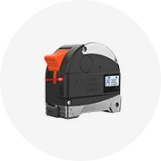
Electronic measuring tapes with ranges of up to 80m. It provides angle measurements with 1-second precision. The vertical compensator improves accuracy on sloped terrains. Comes with Bluetooth to wirelessly transfer data to mobile devices.
Sd digital theodolite
Key features of the Sd digital theodolite include:
Displays angle measurements on an easy-to-read LCD screen. Uses a laser for high precision over long distances. Sealed and dustproof design works in tough weather. Takes measurements quickly, only 0.5 seconds between them.
Sdsr-360 Dual Display
Notable features of the South sdsr-360 Dual Display include:
Sdr-1000
Key features of the Sdr-1000 include:
Using South surveying instruments starts with properly setting up the instrument over a marked point known as a station, usually a survey marker. This is done by leveling the instrument using the built-in spirit bubbles or electronic level features. The operators then take readings of angles or distances to other known points or targets. These measured data are recorded and processed to compute the precise locations of the points on the construction site. The computations give vital information like placement of structures, roads, or utilities. Correctly using these tools ensures projects are built exactly as designed to prevent costly mistakes.
Regular checks for any damage like cracks in the lens or bent parts are important to ensure accuracy. Cleaning the lens and outside parts regularly keeps them clear. A climate-controlled case protects instruments from moisture and extreme temperatures that could harm them. Keeping instruments calibrated makes sure measurements stay precise. Instruments should be sent to a certified repair centre where expert technicians have special tools to fix small broken parts and replace worn-out pieces. Using official South parts for repairs keeps instruments working as they should. Special care during use and storage protects the instruments and keeps surveys accurate.
Using multiple surveying tools together improves accuracy since each instrument covers small precision errors the others might miss. Just like the eyes work better when both are working together to see clearly, multiple surveying tools provide a complete view of the land. The data from each tool is integrated into computer programs that analyse the combined information to create precise maps and models of the site. Using different types of tools together helps make sure all the measurements are as exact as possible, which is important for building projects to be safe and on the right plan.
Proper outdoor safety
Surveying usually takes place in uncontrolled and changing work zones. It's therefore very important for crews to pay close attention to their surroundings and any potential dangers like heavy equipment, traffic, or changing ground conditions. To prevent harm, surveying personnel should also be protected from the weather by routinely monitoring temperature extremes, wet terrain, and conditions likely to result in falls.
Equipment safety procedures
Hardware and software surveying tools also require great care. To avoid harm from incorrectly measuring data or failing to function properly, it's important to maintain instruments like total stations and GNSS receivers, keep them clean, and learn how to use them properly. Yet another safety technique is checking for underground utilities and obstructions before taking measurements. This will help avoid future injuries.
Driving safety
Surveyors frequently have to drive long distances on various kinds of roads to reach work sites. As such, accidents from poor vehicle maintenance or risky driving habits are common. To counter this, vehicles should be maintained well and surveying crews instructed to follow safe driving practices. Given the unpredictability of job sites, surveyors should always go through safety procedures for both driving and working outdoors.
A1. South surveying instruments measure distances and angles on land. Surveyors use them to create accurate maps of areas where buildings and roads will be located. Construction workers also rely on these tools to make sure projects are built straight and level, following the planned designs precisely. Overall, these instruments are necessary for ensuring accuracy in any work involving changes to the land.
A2. South surveying instruments work well outdoors, as they are built to tolerate rough weather and tough ground over which they are normally utilised. They won't be easily damaged by dirt, rain or even extremely harsh temperatures. To make sure the precise measurements they take outside are correct, they must withstand all the elements and conditions they face during their lifetime.
A3. Many South surveying tools have wireless capability. This makes it easy to transfer data between them quickly and accurately. It also makes it much easier for surveyors, who often need to send information from one instrument to another or to a computer, to be more efficient in their work. Their wireless features help modernize the surveying process by removing wires and cables that usually connected everything.
A4. South surveying instruments are designed with strong casings that can survive getting wet for a short period. This includes heavy rain or immersion in water up to 1 metre deep. This allows them to keep working properly even when the weather is bad or in wet conditions. Their waterproof design protects the internal components from getting damaged and keeps them functional in whatever condition.
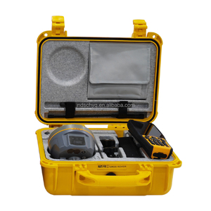
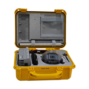
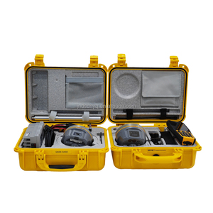
A5. Surveying instruments should be carefully stored in a special hard case that protects them from bumps, breaks and outdoor elements. The case protects them when not in use and during transport. The case usually keeps them organized so that when the surveyor is on the job, they can easily find the instrument they need to make accurate measurements.