All categories
Featured selections
Trade Assurance
Buyer Central
Help Center
Get the app
Become a supplier
(1537 products available)


 Ready to Ship


 Ready to Ship
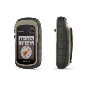


Land survey GPS equipment can be grouped using different criteria, such as reception capability, type of measurements taken, and mode of operation. Below is a list of the common types of land survey GPS equipment.
These receivers take over diffraction, where the survey lines are few but with high precision. High accuracy is needed, and some of the circumstances that require this precision are boundary disputes and mining. These GPS receivers can use different types of correction signals, such as carrier phase, real-time, and post-processing.
These systems also associate with high accuracy but provide real-time data. An RTK system is famous for construction projects and road mapping. RTK systems use base stations to provide immediate correction to the moving GPS unit, significantly improving accuracy within a few centimeters.
Static systems are also used in long-term surveys but need more time for the survey process. These systems are suitable for large areas where only ballpark measurements are needed. Measured points can be left for days, which helps improve the overall accuracy of the survey.
These systems consolidate several survey points to increase coverage while retaining accuracy. The system uses multiple base stations to fill in where a single base station couldn't cover, forming a network of stations mapped to a central controller. The key advantage of a network RTK system is that it can cover larger areas efficiently while still giving centimeter-level accuracy. NRTK is ideal for big or prolonged projects where control points are far apart.
PPK systems are similar to RTK in that they take advantage of base station data for correction. The major difference is that these systems correct the data after the survey is recorded, not in real time. This post-processing method allows surveyors to gain highly accurate results while using fewer resources. It's beneficial in locations with poor satellite coverage, making real-time correction difficult.
PPK is well suited for highly technical projects where precision is critical as these projects allow more time for data treatment.
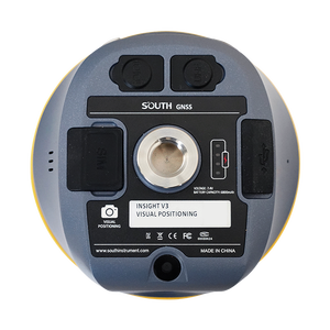
Recent advancements in satellite navigation technology have resulted in the application of GNSS (Global Navigation Satellite Systems) for surveying. These include multiple satellite systems like GPS, GLONASS, Galileo, and BeiDou. Integrated GNSS receivers track satellites from different systems to enhance precision and reliability.
GNSS equipment is ideal for dynamic environments as they provide greater sky coverage and signal strength. By tracking more than one system, these receivers can give more robust positioning data, especially in difficult terrain or urban canyons, where satellite signals are blocked or weakened.
Land survey GPS equipment features vary based on technology and intended usage. Here are some common features found in land survey GPS equipment:
For land surveying, accuracy and precision are the main premium parameters. The precision of a system can be determined using metrics such as horizontal and vertical dilution of precision (HDOP and VDOP). However, an accuracy of a few centimeters is often regarded as adequate for most detailed surveys. RTK GPS systems can achieve pinpoint accuracy; static GPS can provide sub-centimeter precision.
GPS surveying utilizes correction signals to improve accuracy. Smart receivers apply these corrections synchronously or after the survey to attain high accuracy. The kinds of correction signals include real time from local stations and post-processing corrections. Other correction signals are the satellite orbit and clock data.
Modern GPS equipment is fitted with memory cards to enable the storage of immense measurement data. It also connects with GIS systems for data analysis. The collected data are coordinate measurements that can be employed to generate maps, plans, and 3D models.
Land Survey GPS equipment also has the capability of connecting to a mobile gadget. The remote control of the device and real-time data transfer are possible with smartphones and tablets. This portable management increases efficiency during fieldwork and allows real-time updates.
The survey equipment must be resistant to harsh environmental conditions, such as moisture, dust, impact, and extreme temperatures. Most survey equipment manufacturers make their equipment sealed and reinforced.
The land survey mapping tool is widely used commercially in several industries, and its precise measurements mean that it delivers great service in most of these commercial applications.
GPS surveying tools improve the laying out of building foundations, roads, and other large projects in the construction industry. They help reduce the time spent on moving dirt and make mapping and install work tasks easier and more efficient.
GPS is used for precision farming so farmers can plant crops, apply fertilizers, and harvest at the correct times. GPS surveying instruments help farmers make their work more efficient and increase crop yields while lessening waste.
In the mining industry, GPS equipment helps locate mineral deposits and plan open-pit and underground mines. Surveying tools track the changing pit walls and underground tunnels to ensure safety and efficiency.
Oil and gas companies depend on GPS for surveys to map pipelines, drilling locations, and offshore platforms. It helps with the installation and maintenance of pipelines by providing accurate routes and environmental analysis.
GPS surveying tools are also beneficial when measuring trees, mapping forest boundaries, and developing sustainable logging plans in the forestry industry. It enables the assessment of timber resources and ensures that logging activities have minimal impact on the environment.
Governments use GPS surveying tools to map roads, bridges, and public facilities. It deals with the location of public utilities, including water and sewer systems, to facilitate accurate infrastructure planning and maintenance.
When choosing land survey gps mapping tools for the customers, a buyer ought to consider various factors to ensure the industries get the proper equipment for their needs. Here are some key considerations:
Accuracy requirements: Different projects demand different degrees of accuracy. Customers may require only submeter accuracy in broad mapping or agricultural applications. In detailed boundary surveys or construction layouts, centimeter-level accuracy may be necessary. Selecting equipment tuned to these accuracy demands is essential to ensure successful outcomes.
Real-time vs. post-processing: Decide if the customers will need real-time corrections for immediate accuracy, such as with RTK systems, or if post-processing data will suffice. Customers focusing on static surveys may not require real-time correction, but those in fast-paced environments like construction typically do.
Satellite tracking capabilities: The surveying GPS equipment should be able to track multiple GNSS satellites for accuracy. Systems that use more than one satellite constellation, such as GPS, GLONASS, Galileo, and BeiDou, provide better sky coverage and positioning data, especially in difficult terrains or urban canyons.
Durability: Surveys are often carried out in difficult environments, so the GPS equipment must be fitted. Look for rugged designs with water and dust protection, shock resistance, and long battery life to ensure the equipment withstands harsh conditions without sacrificing performance.
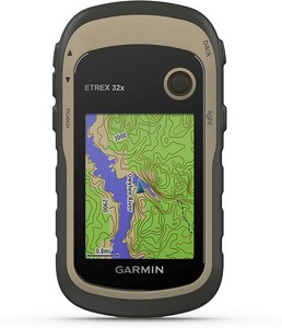
Ease of use: To enhance productivity, select GPS equipment designed for the user interface. Features like touch screens, straightforward menus, and user-friendly software can ease training and quick data collection, especially for customers new to GPS surveying.
Budget considerations: Set a budget before selecting the items. Surveying GPS equipment prices can differ widely, depending on features and accuracy levels. Consider the project demands against the cost to ensure the investment matches the customer's requirements.
A1: RTK (Real-Time Kinematic) involves using live corrections for high-accuracy positioning, while PPK (Post-Processing Kinematic) uses recorded corrections to achieve accuracy after the survey, making RTK suitable for real-time needs and PPK for projects allowing data analysis time.
A2: Tracking multiple satellite constellations improves accuracy and reliability, providing better positioning data, especially in challenging environments like urban areas or thick forests, ensuring more robust and accurate surveys.
A3: Correction data, which might be applied in real-time or through post-processing, compensates for atmospheric effects, satellite position errors, and other inaccuracies, allowing the equipment to adjust its measurements and thus achieve centennial or better accuracy.
A4: Considering the harsh conditions, like weather, terrain, and fieldwork impact, choosing durable GPS equipment with waterproofing, shock resistance, and long battery life ensures reliability, minimizes downtime, and supports extended outdoor use.
A5: Yes, they are applied within the construction, agriculture, mining, and oil and gas companies due to the requirement of precise measurements for tasks like site planning, crop monitoring, resource mapping, and infrastructure development in those industries.