All categories
Featured selections
Trade Assurance
Buyer Central
Help Center
Get the app
Become a supplier
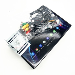
(1352 products available)


 Ready to Ship


Hyundai navigation maps are essential for accurate navigation and are available in various types. The most common types of navigation maps include the following:
Physical Maps
Physical maps are tangible maps that one can touch and see. They are designed to assist users in navigating their surroundings without relying on technology. Even though they lack the features of modern maps, they are still useful.
Political Maps
Political maps focus on showing the boundaries between countries, states and cities. They also include important cities and capital locations. The map is designed to help people understand political divisions and relationships worldwide.
Topographic Maps
Topographic maps show the shape of the land and its features, such as mountains, valleys, and lakes. They use lines called contour lines to connect points at the same height above sea level. This helps people see the land's shape and steepness. Topographic maps are used for hiking, planning, and understanding the landscape in detail.
Climate Maps
Climate maps use colors to show different regions' average temperatures and rainfall. They help people understand the climate in various places. For example, a map might show deserts with low rainfall and tropical areas with high rainfall. Climate maps are crucial for farmers, travelers, and others who need to know about the weather in different locations.
Geological Maps
Geological maps display the types of rocks and minerals found in an area. They use colors and symbols to indicate different geological features, such as fault lines or volcanoes. Geological maps are helpful for scientists studying the Earth's structure and resources, like where to find minerals or oil.
Hiking Trail Maps
Hiking trail maps are made for showing the routes and trails in areas meant for hiking. They indicate the paths, parking areas, campgrounds, and other important locations that hikers often visit. Hiking maps are crucial for hikers to navigate and ensure they stay on the right path during their adventures in nature.
Street Maps
Street maps are detailed maps that show the layout of streets and roads in a city or town. They help people navigate urban areas, find addresses, and plan routes within cities.
Satellite Maps
Satellite maps use pictures taken from space satellites to show the Earth's surface. They provide a visual representation of the land, including buildings, trees, and roads. Satellite maps give a broader view of locations, helping users see the terrain and surroundings in detail.
Shaded Relief Map
The shaded relief map uses shadows and colors to show the height and shape of the land. This makes it more accessible to understand the landscape's features and how they look. Shaded relief maps are helpful for visualizing topography and geographical details.
Every navigation system has specifications that must be considered while using it. Here are some specifications to keep in mind when using the Hyundai navigation system.
Here are some maintenance tips for users of the Hyundai navigation system.
Choosing the right navigation system is crucial for businesses in vehicle parts and accessories. Here are some key factors to consider:
Compatibility
Consider whether the navigation maps are compatible with the existing navigation system in Hyundai vehicles. Ensure they match the device's model and year to avoid any performance issues or errors.
Coverage Area
Select maps that cover the regions most relevant to the business's operations. If the business operates nationally, opting for maps with comprehensive country coverage and detailed routes is essential. For international operations, consider maps that provide cross-border navigation and support multiple languages.
Map Updates
Check the frequency of map updates and the availability of update services. Roads change, new constructions emerge, and businesses open, so keeping the maps updated is vital for accurate navigation. Choose suppliers that offer regular updates and convenient update methods, such as online downloads or USB transfers.
Point of Interest (POI) Data
Consider the included Point of Interest (POI) data. POIs can significantly aid businesses in locating essential destinations, including service stations, hotels, restaurants, and distribution centers. Ensure that the maps have extensive and updated POI information to assist in efficient planning and decision-making.
Route Optimization
Evaluate the navigation system's route optimization capability. For businesses, minimizing travel time, fuel costs, and wear and tear on vehicles is crucial. Choose navigation systems that consider real-time traffic conditions, historical traffic data, and customizable route preferences to achieve optimal routing.
Customer Support
Consider the quality of customer support offered by the navigation map supplier. Choose suppliers with responsive customer support who can assist in installation, troubleshooting, and any other needs. Reliable customer support can save businesses valuable time and resources.
Cost
Consider the navigation maps' cost in relation to their features and the required frequency of updates. While choosing maps that fit the budget is essential, prioritize quality and accuracy to minimize long-term costs.
By carefully considering these factors, businesses can select navigation maps that suit their needs and enhance operational efficiency. Reliable navigation is crucial for timely deliveries, route planning, and optimizing logistics processes, ultimately benefiting business performance.
Some steps to follow when installing updated hyundai navigation maps are listed below.
Q1: How do I know if I need a map update?
A1: If the map update is required, users will notice an update prompt on the screen. Additionally, if users notice that some roads, points of interest, and locations are not available in the maps, it could mean that an update is due.
Q2: How many times will I update my Hyundai navigation maps?
A2: Users will update their maps only once every year. The available updates will depend on the specific navigation system and the maps installed in the vehicle.
Q3: Can I drive using the navigation system while the map updates are in progress?
A3: Yes, users can continue driving while the map update is in progress. The navigation system will remain functional during the update process.
Q4: Does the map update require an internet connection?
A4: Yes, an internet connection is required to download the update package. Additionally, the update process requires the connection to be stable and fast.