All categories
Featured selections
Trade Assurance
Buyer Central
Help Center
Get the app
Become a supplier
(504 products available)


There are several types of Topcon GPS systems, each designed to meet specific needs and applications in various industries. Here are some common types of Topcon GPS systems:
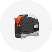
Topcon GNSS Receiver:
Topcon GNSS receivers are advanced GPS receivers that use Global Navigation Satellite System satellites for surveying and construction. These receivers provide precise positioning by processing signals from multiple GNSS satellites, including GPS, GLONASS, Galileo, and BeiDou. The flexibility of Topcon GNSS receivers allows them to connect to various GNSS networks and adapt to different surveying methods, such as static, kinematic, and real-time differential.
Topcon HiPer Series:
Topcon HiPer Series receivers are designed for high-precision GNSS surveying applications. They have dual-frequency GNSS capabilities, allowing them to receive signals from all available GNSS satellites. The HiPer series receivers also feature advanced signal processing and noise reduction technologies, ensuring reliable and accurate positioning in challenging environments. These receivers are commonly used in land surveying, geodesy, and engineering projects requiring high accuracy.
Topcon GT Series Total Stations:
Topcon GT Series Total Stations are robotic total stations that integrate GNSS capabilities for precise field measurements. The GT Series Total Stations combine angular and distance measurement abilities with GNSS receivers to provide comprehensive positioning solutions. Surveyors can achieve high efficiency and accuracy in various surveying tasks, such as boundary surveys, construction staking, and monitoring, thanks to their robotic functionality and GNSS integration.
Topcon Land Surveying Equipment:
Topcon manufactures a variety of land surveying equipment, including levels, theodolites, and electronic distance measurement (EDM) instruments. While these instruments may not be directly related to GNSS, they can be integrated with Topcon GNSS receivers for enhanced positioning and data collection capabilities. This integration allows surveyors to leverage the strengths of GNSS technology alongside traditional surveying methods, ensuring accuracy and reliability in all surveying tasks.
Topcon Construction GPS:
Topcon construction GPS solutions are tailored for civil engineering and construction projects. These systems provide real-time positioning and machine guidance, improving construction site efficiency and accuracy. With Topcon construction GPS, stakeholders can monitor equipment movements, manage resources, and ensure adherence to design specifications in real time, from earthworks and grade control to asphalt paving and concrete placement.
Regular cleaning:
Regular cleaning of Topcon GPS equipment is necessary for maintenance. Dust, moisture, and other contaminants should be removed from the devices to avoid damage to the sensors and the internal circuits.
Software updates:
Software updates are essential for maintaining Topcon GPS accuracy and performance. On a regular basis, the manufacturers' official website should be checked for updates that need to be downloaded and installed in accordance with the instructions.
Battery maintenance:
Battery maintenance is necessary for the proper operation of Topcon GPS devices. The battery should be charged and discharged in accordance with the manufacturer's recommendations in order to attain the maximum battery life and performance.
Regular calibration:
Regular calibration is necessary for maintaining the accuracy of Topcon GPS devices. The calibration equipment should be used in accordance with the manufacturer's recommendations on a regular basis to ensure that all devices are in accordance with the established standards.
Mechanical inspection:
Topcon GPS devices' mechanical components should be regularly inspected for wear and damage, such as housings, batteries, and mounts. If any issues are found, the components should be repaired or replaced as needed.
Data management:
Data management is essential for the efficient use of Topcon GPS devices. Collected data should be organized, backed up, and stored in accordance with the user's needs and applicable data management policies.
Environmental conditions control:
Topcon GPS devices should be monitored to ensure they are used in accordance with the prescribed environmental conditions (temperature, humidity, etc.). Such control will prevent the devices from being damaged by environmental factors.
Choosing a Topcon GPS system for a business requires careful consideration of several factors to ensure the selected system meets the operational needs and budgetary constraints. Here are some of them:
Application Requirements:
Businesses need to evaluate their operations and the purpose of GPS use. Whether for surveying, construction project management, agriculture field mapping, or real-time vehicle tracking, the application determines the Topcon GPS model to choose.
Accuracy and Reliability:
Businesses should consider their required accuracy levels and the Topcon GPS system's reliability in providing consistent performance. Different models may offer varying accuracy levels, such as centimeter or sub-centimeter precision.
Budget:
Businesses should set a budget for the Topcon GPS system, including the initial purchase, accessories, software, and ongoing maintenance or subscription costs. They should compare the features and performance of different models within their budget to find the best value.
Ease of Use:
Businesses should consider the GPS system's user interface, data processing software, and overall ease of use. A system that is intuitive and easy to operate will reduce training time and increase productivity.
Durability and Environmental Conditions:
Businesses should choose a durable Topcon GPS unit that can withstand harsh environmental conditions, such as extreme temperatures, dust, or moisture. Depending on the application, ruggedized or weather-resistant models may be necessary.
Communication and Connectivity:
They should evaluate the available communication options in the Topcon GPS system, such as cellular, Bluetooth, or Wi-Fi. They should consider the required data transmission range, bandwidth, and reliability based on their operational requirements.
Integration with Existing Systems:
Businesses should consider the Topcon GPS system's compatibility with their existing equipment and software. Seamless integration with other devices and software will ensure smooth operations and efficient data management.
Customer Support and Service:
Businesses should research the availability and quality of customer support and service for the chosen Topcon GPS system. Reliable technical support, training, and after-sales service are essential for smooth operation and problem resolution.
Scalability and Future-Proofing:
Businesses should consider the GPS system's scalability to accommodate future growth and changing technological advancements. Choosing a system with upgradeable components and features will ensure long-term investment.
Field and Office Software:
Businesses should evaluate the Topcon GPS system's included or compatible field and office software. Powerful data processing, analysis, and reporting tools are essential for efficient data management and decision-making.
Training and Support:
Businesses should consider the availability of training and support for the selected Topcon GPS system. Ensure that the manufacturer or dealer offers adequate training and ongoing support to maximize the system's capabilities.
By considering these factors, businesses can select a Topcon GPS system that meets their specific needs, enhances operational efficiency, and provides a reliable return on investment. It may also be a good idea to consult with experts or authorized Topcon dealers to evaluate and recommend the most suitable system for specific business requirements.
Replacing Topcon GPS equipment can be a DIY-friendly task. But, it is important to have a professional handle complex tasks. Here are the basic steps to replace Topcon GPS equipment:
Power off the Unit
This is the first and most important step. It is important to power off the existing unit before replacement to avoid accidents and data loss.
Remove the Existing Unit
Once the existing unit is powered off, the next step is to remove it from its mounting location. This includes disconnecting it from any power sources, removing any mounting hardware, and carefully detaching it from its installed location.
Prepare the New Unit
Preparing the new unit before installation is very important. Preparation involves gathering all necessary tools and ensuring the new unit is charged and ready for operation.
Install the New Unit
Once the new unit is prepared, it's time to install it. This includes placing the unit in its designated location, securing it with mounting hardware, and connecting it to any necessary power sources.
Power on the New Unit
Once the new unit is installed, and all connections are made, users should power it on. This step is crucial to ensuring that the unit functions properly and is ready for use.
Configure the New Unit
After powering on, users should configure the new unit according to their preferences and requirements. This includes setting up connections, customizing settings, and installing necessary applications.
Test the New Unit
Once the new unit is configured, it's important to test it to ensure all functionalities work as expected. This step helps identify and address any issues that may arise during installation and setup.
Q1: How accurate is Topcon GPS?
A1: The accuracy of Topcon GPS depends on the system used. The Topcon GB-1000 is accurate to within 1 meter. The Topcon Hiper II is accurate to within 1 centimeter. The Topcon Hiper V is accurate to within 5 millimeters. The Topcon HiPer SR is accurate to within 1 millimeter.
Q2: How long does a Topcon GPS survey take?
A2: The time it takes to complete a Topcon GPS survey depends on various factors, including the size of the survey area, the number of GPS units used, and the survey's required accuracy. In general, GPS surveys take longer than traditional surveying methods but offer greater accuracy and efficiency in the long run.
Q3: Can a Topcon GPS be used for real-time kinematic (RTK) positioning?
A3: Yes, Topcon GPS units can be used for RTK positioning. Topcon offers GPS units specifically designed for RTK applications, providing centimeter-level accuracy in real-time.
Q4: Is training required to operate a Topcon GPS unit?
A4: While Topcon GPS units are designed to be user-friendly, training can help operators utilize the equipment effectively and understand its full capabilities. Topcon and its dealers often provide training programs for users.
Q5: Can Topcon GPS be integrated with other Topcon instruments?
A5: Yes, Topcon GPS units can be integrated with other Topcon instruments, such as total stations and laser systems, allowing for a more comprehensive data collection and workflow integration.