All categories
Featured selections
Trade Assurance
Buyer Central
Help Center
Get the app
Become a supplier
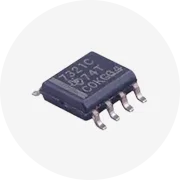
Hot Selling Original P+F
LiDAR
Sensors
OMD30M-R2000-B23-V1V1D-HD-1L
Cheap
Spot
$
1
,000
Min. Order: 1 set
Alibaba
Electronic Components, Accessories & Telecommunications
Sensors
Other Sensors
Cheap lidar sensor
(825 products available)
Previous slide
Next slide
Hot Selling Original P+F
LiDAR
Sensors
OMD30M-R2000-B23-V1V1D-HD-1L
Cheap
Spot
$1,000
Min. Order: 1 set
Previous slide
Next slide
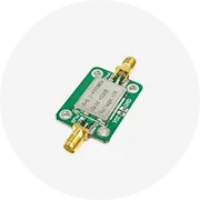
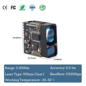
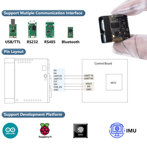
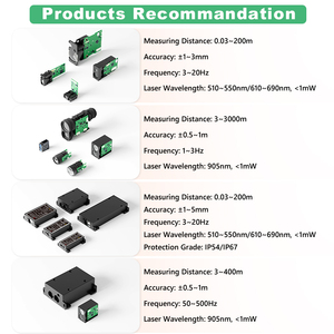
LDL 10m Short Range Laser Distance
Sensor
TTL Serial High Precision
Lidar
Laser Distance
Sensor
Ready to Ship
$38.85-48.56
Shipping per piece: $16.69
Min. Order: 2 pieces
Previous slide
Next slide
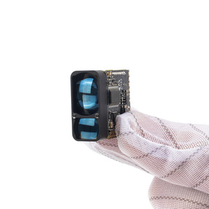
Industrial Obstacle Avoidance
Lidar
AS-33C TOF High Reliability Unique Design Accurate 2D Scanning Laser
Lidar
Area Safety
$200-380
Min. Order: 1 piece
Previous slide
Next slide
TS1224 1200m Lightweight Single Point
Lidar
Laser Distance
Sensor
For UAV 905nm Class 1 Drone Laser Rangefinder
Ready to Ship
$133.50-166.88
Shipping per piece: $13.81
Min. Order: 1 piece
Previous slide
Next slide
Pacecat
Lidar
Scanner Laser Scan
Lidar
With High Ranging Accuracy
Sensor
Obstacle Aviodance Robot For AGV
$330-360
Min. Order: 1 piece
Previous slide
Next slide
Cheap
price PaceCat Handheld 3d Imaging Scanner Photoelectric
Sensor
Lidar
360 degree
$180-290
Min. Order: 2 pieces
Previous slide
Next slide
Best Price Robot Sense
LiDAR
the First Fully Solid-State Digital
LiDAR
for Robots
$1,000-1,200
Shipping per piece: $30.68
Min. Order: 1 piece
Previous slide
Next slide
Hot-selling Original SICK TIM361S-2134101 2D
LIDAR
SENSORS
in Stock at Low Price
$800
Min. Order: 1 set
1
2
3
4
5
More pages
21
Top categories
Passive Components
Discrete Semiconductors
Power Supplies
Telecommunications
Development Boards, Electronic Modules and Kits
Audio Components and Products
Electronic Accessories & Supplies
Sensors
Wireless & IoT Module and Products
PCB & PCBA
Displays, Signage and Optoelectronics
Circuit Protection
Connectors, Terminals & Accessories
Isolators
RF, Microwave and RFID
Relays
Previous slide
Next slide


 Ready to Ship


 Ready to Ship