Introduction to Chart GPS
The world of navigation has evolved significantly with the advent of chart GPS technology. Chart GPS combines advanced satellite positioning systems with digital maps and nautical charts, providing mariners, fishermen, and outdoor enthusiasts with precise location data. This state-of-the-art tool not only enhances navigation accuracy but also ensures safety and efficiency in various waterway activities.
Types of Chart GPS
There are several types of chart GPS systems, each tailored to meet diverse needs:
- Marine GPS Chart Plotters: Specifically designed for maritime use, these devices integrate GPS data with cartographic charts, allowing users to plot their course effectively.
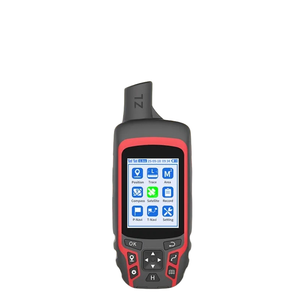
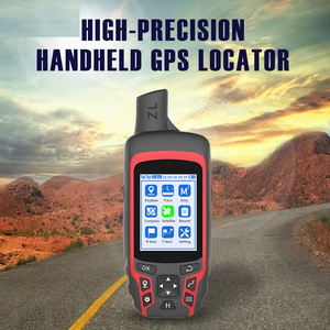
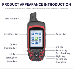
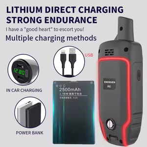
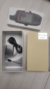
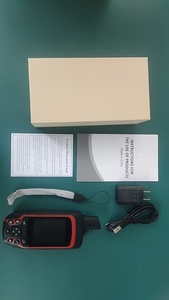
- Handheld Chart GPS Units: Ideal for fishermen and recreational maritime users, these portable devices offer mobility without sacrificing navigation accuracy.
- Smartphone and Tablet Apps: Numerous applications provide GPS chart functionality, offering a more accessible and cost-effective alternative for casual users.
- Integrated Navigation Systems: Often found in larger vessels, these systems combine multiple technologies, such as radar and sonar, with chart GPS capabilities for comprehensive navigation.
Features and Functions of Chart GPS
The functionality of chart GPS systems is packed with features designed to enhance navigational prowess:
- Real-time Positioning: Offers instant updates on your location with remarkable accuracy, critical for safe navigation.
- Route Planning: Allows users to create, save, and edit routes, optimizing travel time and fuel efficiency.
- Nautical Charts: Provides access to detailed nautical maps, including depth, currents, and potential hazards.
- Waypoint Management: Users can mark specific locations, helping them return to fishing spots or points of interest quickly.
- Weather Integration: Some systems include real-time weather updates, ensuring users can plan trips safely and avoid stormy conditions.
Applications of Chart GPS
Chart GPS technology finds extensive application across various sectors, emphasizing its value:
- Commercial Fishing: Fishermen utilize chart GPS for tracking fish locations, ensuring they target the right areas efficiently and safely.
- Recreational Boating: Boat enthusiasts benefit from precise navigation and exploration of new waterways, enhancing their overall experience.
- Marine Research: Scientists and researchers leverage chart GPS to collect accurate data for marine studies, water quality assessments, and environmental monitoring.
- Search and Rescue Operations: Emergency services employ chart GPS to locate vessels or individuals in distress, increasing response effectiveness.