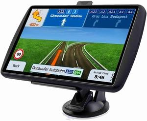
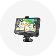
Types of Car GPS Navigation With Navitel Maps
Car GPS navigation with Navitel maps has emerged as a reliable and accurate navigation solution for drivers, offering real-time traffic info and detailed maps of various regions. These GPS devices come in different types, each tailored to meet specific requirements and preferences.
-
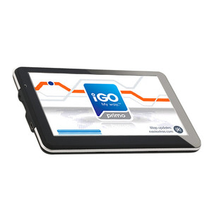
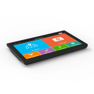
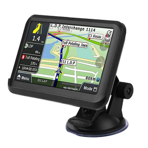
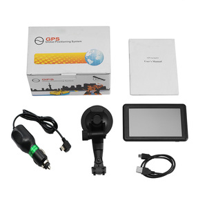
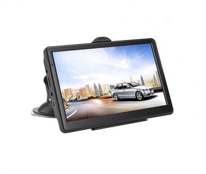
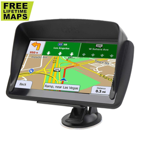
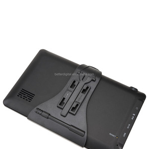
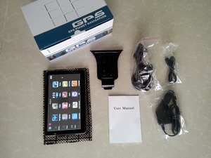
Portable Car GPS Navigation
Portable car GPS navigation devices are independent and can be used in any vehicle. They often have a rechargeable battery, a touchscreen display, and user-friendly interfaces. Their portability makes them attractive to people who frequently travel or change vehicles. Besides, portable car GPS navigation can be updated with new maps and software.
-
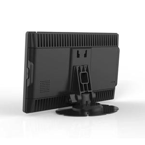
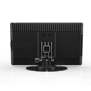
Built-in Car GPS Navigation
Many modern cars come with a GPS navigation system integrated into the dashboard infotainment system. This built-in navigation system provides a seamless experience since it connects to other vehicle parts like the audio system and the steering wheel controls. Furthermore, built-in car GPS navigation often gets real-time traffic updates and can be connected to the internet.
-
Smartphone GPS Navigation
Smartphones are vital in modern life, and many come with built-in GPS for navigation. Users can download various navigation apps offering different features, including real-time traffic updates, voice directions, and offline maps. Some popular navigation apps include Google Maps, Waze, and Apple Maps. Besides, GPS navigation on smartphones is often free or available at a lower cost than dedicated GPS devices. They also receive frequent updates, improving their functionality and features over time.
-
Handheld GPS Navigation Devices
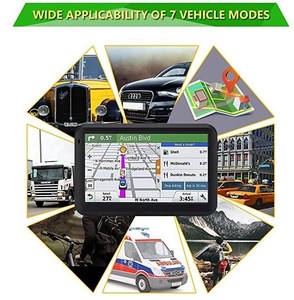
Handheld GPS navigation devices are portable and designed for outdoor activities like hiking, biking, and geocaching. They offer detailed topographic maps and can track users' trails. Although they are not specifically designed for use in cars, some can be mounted on dashboards or windshields using appropriate mounts and adapters.
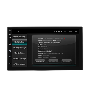
Specifications and Maintenance of Car GPS Navigation with Navitel Maps
Car GPS navigation with Navitel maps has several specifications that make them ideal for use in vehicles. They include the following:
-
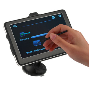
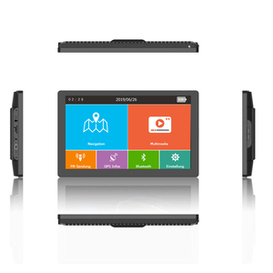
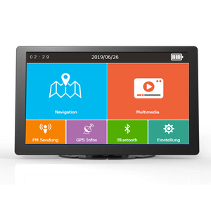
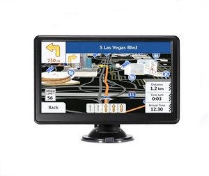
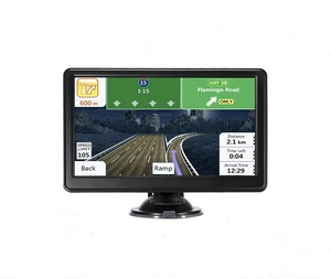
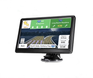
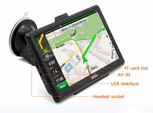
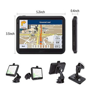
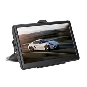
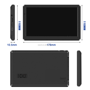
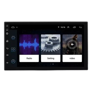
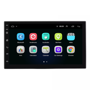
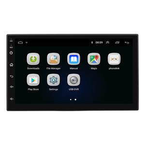
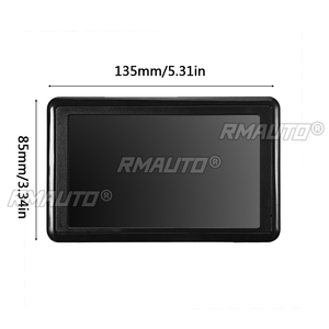
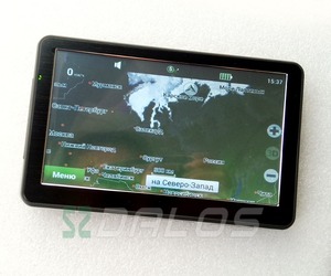
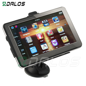
Display
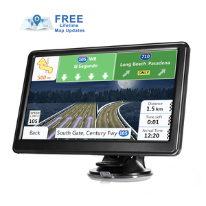
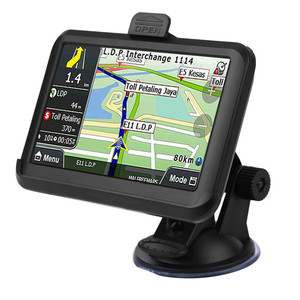
Some car GPS navigation with Navitel maps has a high-resolution display of about 800 x 480 pixels. They also have a touchscreen interface that allows users to interact with the map easily.
-
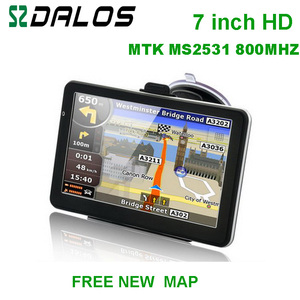
Processor
Car GPS navigation with Navitel maps have a powerful processor of about 600 MHz. The processor enables the GPS to run complex calculations and tasks smoothly.
-
RAM
Car GPS navigation with Navitel maps have a RAM of about 128 MB. The RAM allows for efficient multitasking and ensures smooth operation of the GPS system.
-
Storage
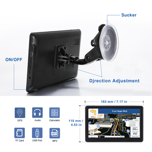
These GPS systems come with built-in storage of about 4 GB. Users can also expand the storage by inserting a microSD card of up to 32 GB. The storage allows users to save maps, routes, and other important data.
-
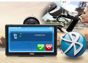
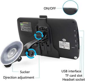
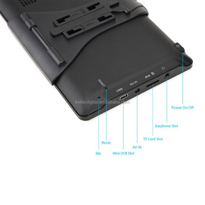
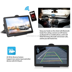
Connectivity
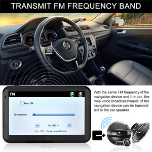
Some car GPS navigation with Navitel maps have Bluetooth connectivity. The Bluetooth allows users to connect the GPS to their smartphones or other devices for hands-free calling and access to additional features.
-
Battery
These GPS systems come with a rechargeable lithium-ion battery of about 1200 mAh. The battery ensures that the GPS can operate even when not connected to the vehicle's power supply.
-
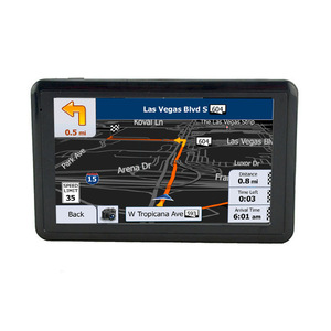
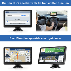
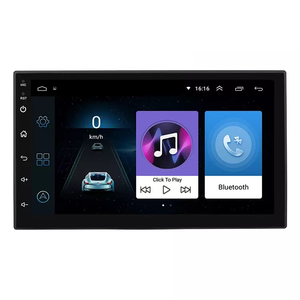
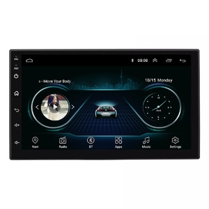
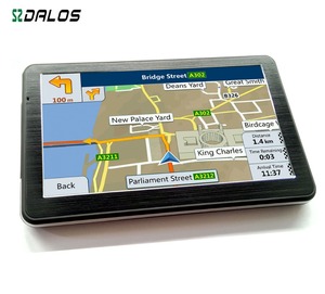
Navigation Features
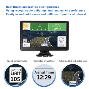
Car GPS navigation with Navitel maps have several navigation features. These features include voice guidance, turn-by-turn instructions, real-time traffic information, lane guidance, and offline maps.
-
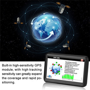
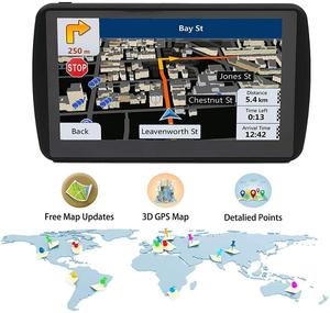
Maps
Navitel maps cover more than 86 countries and offer detailed mapping information. The maps also feature millions of points of interest, including hotels, restaurants, and gas stations.
-
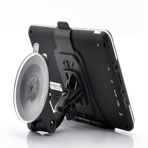
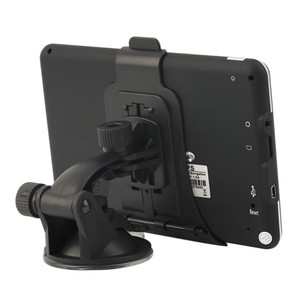
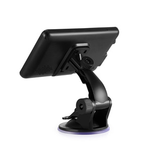
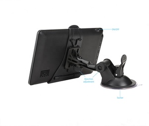
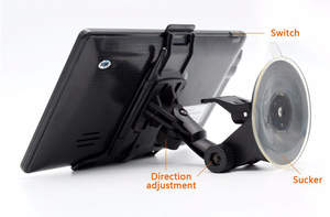
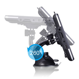
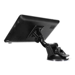
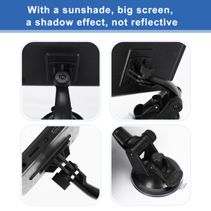
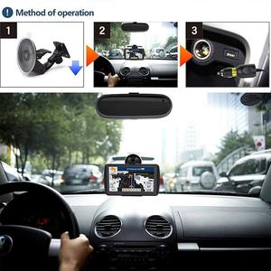
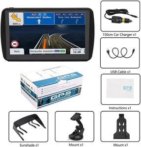
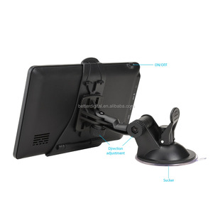
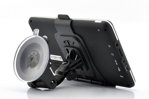
Mounting Options
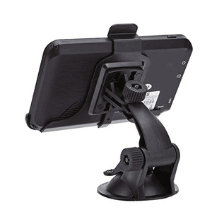
Car GPS navigation with Navitel maps come with different mounting options. The options include windshield mounts, dashboard mounts, and portable mounts. The various mounting options allow users to choose the one that suits their needs.
Below are the maintenance requirements for car GPS navigation with Navitel maps:
- Software Updates: Always update the software and maps of the car GPS navigation with Navitel maps regularly. The updates improve features and fix bugs.
- Clean the Screen: Use a soft cloth and mild cleaner to clean the touchscreen of the car GPS navigation system gently. Avoid using abrasive materials that can damage the screen.
- Check the Mounting: Ensure that the GPS system is securely mounted. Loose mounting can cause the device to fall or become unresponsive.
- Power Supply: Ensure that the GPS receives power from the vehicle's power supply. Check the cables and connections regularly to avoid power interruptions.
- Backup: Important data, such as saved routes and favorite locations, should be backed up. If users need to reset or replace the GPS system, the backup will help them recover the data.
- Environmental Considerations: Avoid exposing the GPS system to extreme temperatures, humidity, or direct sunlight. Such conditions can damage the device and affect its performance.
- Regularly Check GPS Performance: Monitor the car GPS performance frequently. If there are any signs of inaccuracy or slow response time, consider troubleshooting or contacting the manufacturer for help.
How to choose a car GPS navigation with navitel maps
To choose the right GPS for one's needs, consider the following:
- Display size and visibility: Select a device with a screen size that is appropriate for viewing while driving. A larger screen offers more excellent map detail but may occupy more dashboard space. Additionally, consider the display's readability in various lighting conditions.
- Ease of use: Look for a user-friendly interface, such as large buttons, straightforward menus, and voice instructions. A simple-to-use navigation system is vital while driving to minimize interruptions. Consider a detachable car GPS navigation system with a flexible mounting option for easy use.
- Mapping and routing: Consider the mapping software's quality and routing capabilities. While some GPS devices allow lifetime map updates, others need a subscription or one-time payment for map updates. Choose a mapping system that provides accurate maps and reliable routing based on personal needs and preferences.
- Voice instructions: Robust voice instructions are essential for safe driving. Select a GPS device that provides clear and precise voice instructions, including street names, to guide users without needing to glance at the screen repeatedly.
- Traffic and weather information: Real-time traffic updates help avoid congested routes and save time. Some GPS devices also offer weather forecasts and alerts, keeping travelers informed about weather conditions that may impact their travel plans.
- Bluetooth connectivity and hands-free calling: If users need to make calls while driving, consider a GPS with Bluetooth connectivity for hands-free calling. This function promotes safer communication on the road by eliminating the need to hold the phone.
- Price and value: Determine a budget for a portable navigation device. Weigh the features and capabilities against the price to find the best value. Sometimes, spending a little more on a quality GPS with the required features can save time and frustration in the long run.
- Battery life and charging options: Consider the portable navigation system’s battery life and availability of charging. A more extensive battery allows for longer usage periods, while various charging options provide more flexibility.
- Additional features: Some car GPS systems offer extra features, such as voice control, multi-destination routing, and custom route preferences. Determine which additional features are essential or beneficial based on personal travel needs and preferences.
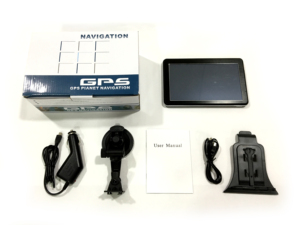
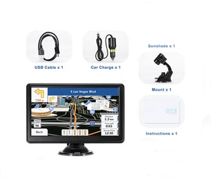
How to DIY and Replace Car GPS Navigation with Navitel Maps
Here are the necessary tools and steps on how to install and replace GPS in a car using Navitel:
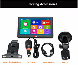
- 1. Car nav installation kit: This includes a dashboard removal tool, mounting brackets, and adhesive pads.
- 2. Screwdriver set: For loosening and tightening screws during installation.
- 3. USB cable: For transferring data and connecting the GPS device to the car's system.
- 4. Power cable: To provide electricity to the new GPS unit.
- 5. Internet connection: Either through mobile data or Wi-Fi, to download Navitel maps and updates.
Follow the steps below to replace and install a car GPS navigation system with Navitel maps:
- 1. Turn off the car's ignition and disconnect the battery to ensure safety during installation.
- 2. Use the dashboard removal tool to take out the old GPS device carefully. Remove any mounting brackets that hold the old GPS in place.
- 3. Clean the area where the new GPS will be installed using a soft cloth and car-safe cleaner. This ensures better adhesion of the mounting brackets.
- 4>Connect the mounting brackets of the new GPS system to the car's GPS system. Ensure they are securely fastened.
- 5. Use the power cable to connect the new GPS system to the car's power supply. This provides power to the GPS device.
- 6. Use the USB cable to connect the new GPS system to the car's GPS system. This allows data transfer between the GPS device and the car's system.
- 7. Once the new GPS system is connected, turn on the car's ignition. The new GPS device should power up.
- 8. Follow the on-screen instructions to set up the new GPS system. Choose language preferences, time zone, and other settings.
- 9. Ensure the new GPS system is securely mounted and functions properly. Test the GPS navigation, audio, and other features to ensure they work correctly.
- 10. Once satisfied with the installation, reconnect the car's battery and drive off with the new GPS device.
Q and A
Q1: What is a car GPS with Navitel?
A1: A car GPS with Navitel is a navigation device or system that uses GPS technology and the Navitel navigation service. This service provides detailed maps and navigation assistance to drivers, helping them find routes and navigate roads.
Q2: Is GPS on a car worth it?
A2: Yes, a GPS in a car is worth it for many users. It provides real-time navigation, traffic information, and route planning, which can be very helpful for drivers.
Q3: What is the benefit of Navitel?
A3: Navitel offers several benefits, including accurate navigation, offline maps, and detailed maps of many regions. It also provides real-time traffic information and alerts, helping users avoid traffic jams and plan optimal routes.
Q4: How does Navitel work?
A4: Navitel works by using GPS for location tracking and data for real-time traffic updates. It provides users with maps, route planning, and voice navigation instructions.


 浙公网安备 33010002000092号
 浙B2-20120091-4